Magical Grotto Hike

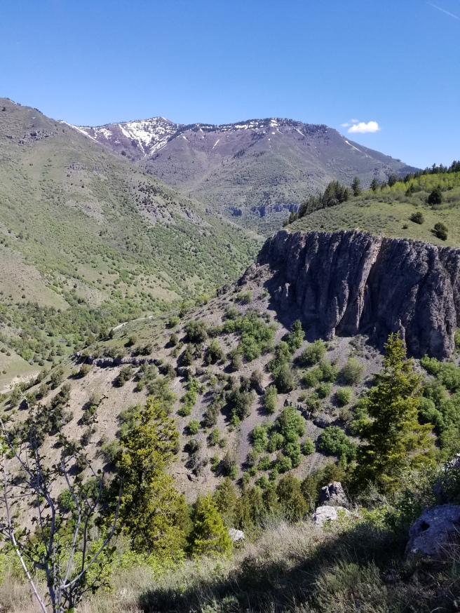
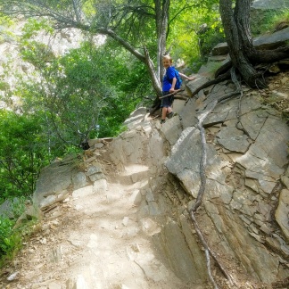
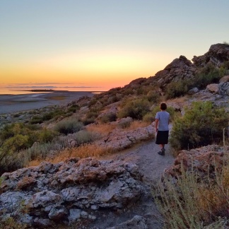
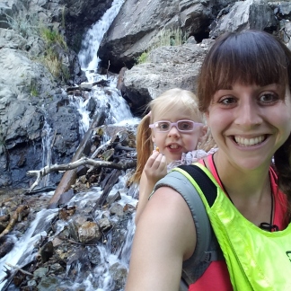
Last year I found a really cool hiking book at the Farmington City Hall in Davis County, Utah.  It has details on over 30 trails in Farmington, Utah (where I grew up).  Even after living in Farmington for 18 years I had never hiked this trail before.  So I grabbed a friend and we went on this hidden gem of a hike to “The Grotto”.  Picture mossy rocks, waterfalls, butterflies and magical dripping weeping rocks.  If fairies are real, they live here.

Farmington Grotto Hike (Steed Creek Trail to Hornet Canyon)

Little Mountaineers Rating: Moderate (around 3 miles round trip.  This hike starts out easy along the Bonneville Shoreline Trail, then as you hike along the Steed Creek Trail it becomes more steep and often very narrow.)

Since my first hike here, I have been back several times and I never see other people around.  The first time I went the waterfall was flowing strong.  This spring the main waterfall was barely a trickle (we’ve had a dry winter).  If you go in the summer the plants can get huge and the trail will seem more overgrown.

My 4 year old hiked part of the way on her own, and I also carried her. My 8 year old hiked this on his own just fine.  I would not recommend this hike for toddlers or preschoolers unless you plan on carrying them and watching them carefully around the tricky/dangerous areas. This hike is better for older kids who are familiar with hiking and being safe on the trail.

My advice when trying a new trail is go without kids the first time, then you can make a better judgement of how your kids will do. For this trail do your research and find good directions because it can be easy to take the wrong turn if you don’t know where you are going.

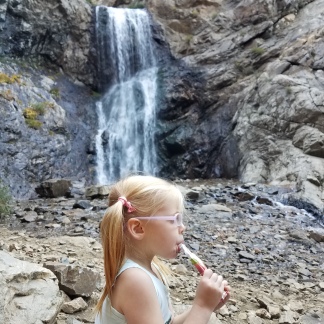
In the photo below I’m standing right where there is sometimes a big strong waterfall!

Happy hiking!

Logan Canyon Adventures

So my mom and several of my siblings live in Cache Valley.  They moved there when I was 18 and had gone off to college so I never lived there.  So for the last 11 years I have made the 1 hour drive to Logan at least once a month.  It has been fun getting acquainted with beautiful Cache Valley.  We’ve been able to explore lots of fun hikes.  Here are our reviews of some of the classics.

Wind Caves

Little Mountaineers Rating: Moderate Hard (3.5 miles round trip that is uphill all the way to the caves.  Over 1000 ft elevation gain and not shaded, some drop offs and cliffs.)

This hike is probably best done Spring, Fall and on shady cooler days since it is mostly exposed.  The caves are cool at the top but they are at a slant so you need to hold on to your little’s so they don’t tumble down!  I carried my 3 year old the whole way and had major anxiety as she wanted to explore the slanted caves that have zero protection from the huge drop off.  Not to scare you or anything but I wouldn’t recommend super little kids on this one!  Older kids will do better, but we went on a hot sunny day and my son was miserable, he did like the caves when we finally got there.  Great workout if you are carrying a 40 lb toddler ha ha.

IMG_20170811_215812_578

Crimson Trail

Little Mountaineers Rating: Hard (3.8 miles round trip, steep climb to the top and steep final descent back to finish the loop.  The top is walking along cliffs.  Mostly not shaded with exception to some forested areas)

I absolutely love this trail.  It has some stunning views at the top and walking along the cliffs is pretty cool.  It is however a steep climb and can be hard for the kids.  I carried my 3 year old the whole way and it was a killer workout.  Older kids who are experienced hikers should do okay but there are definitely some dangers.

20170511_11305420170511_11233720170511_11231520170511_111820

White Pine Lake

Little Mountaineers Rating: Moderate Hard (7.5 miles round trip, mostly mild elevation gain, a little bit of a climb at the beginning and one steeper climb when you turn around and make your way back from the lake, mostly rated hard for distance)

This trail is absolutely incredible!  Even if you only do part of it with your family I totally recommend it.  I know the distance can scare most people away, but there are many flat areas and while the lake is a great destination, the whole hike is scenic so even if you do the first mile or two it will be worth it.  My 7 year old did the whole hike no problem besides the typical “when are we going to be there mom??” and my 3 year old was in and out of her carrier.

This hike makes you feel like you are in the middle of the wilderness, far from civilization.  It was stunning when we went in the summer during peak wildflower season, I bet it would be awesome in the fall before the snow comes.  The lake is incredible too!  I seriously can’t rave enough ha ha.  This is a popular trail for backpacking, there are several little campsites near the lake.

IMG_4261IMG_4287IMG_4535IMG_4329IMG_4337IMG_4532IMG_4445IMG_4446IMG_4516IMG_4517

Tony Grove Lake Nature Trail

Little Mountaineers Rating: Easy Moderate (1.2 miles round trip, 100 ft of elevation gain)

This is a beautiful nature trail around the Tony Grove Lake.  Lake loop trails are the best!  This trail also has great wildflowers in the summer.  We did the trail and then hung up our hammocks and had a relaxing afternoon.  You can also bring kayaks, paddle boards, etc and play in the water!  There is a campground right by the lake as well.

20160701_114420_1467405372632-0120160701_114959_1467405379961-0120160701_115651_1467405384234-0120160701_122518_1467405444055-0120160701_125631_1467405427704-01

Hobbit Caves

Little Mountaineers Rating: Easy (less than .5 mile, flat, mostly exploring not so much a hike)

This is a funny little area for kids to explore.  It is near the stream and a little waterfall so just be careful with the little ones.

20160905_14250520160905_14115420160905_141636

Canyonlands: Island in the Sky

For spring break we decided on a spontaneous trip.  Our only requirements were that it was somewhere south with warmer weather!  We ended up staying at a hidden gem of a campsite in Green River, UT (more info at the end of this post!) and found ourselves exploring Canyonlands National Park for a couple days.

Island in the Sky district is the most accessible area of Canyonlands so with our limited time we decided to check it out and leave Needles and Maze districts for another time.  I was also super smart this trip and forgot my hiking shoes (slip on Tevas for the win) so I wasn’t going to be able to do any super long hikes.  We ended up getting a great little taste of Canyonlands and can’t wait to come back!

Whale Rock

Little Mountaineers Rating: Easy-Moderate. 1 mile round trip fun trail with climb up on top of a giant sandstone rock.  Great views on top, just watch little ones so they don’t tumble down.

Upheaval Dome

Little Mountaineers Rating: Easy-Moderate. 1 miles round trip to the first viewpoint and some elevation gain with some stairs.

Grand View Point

Little Mountaineers Rating: Easy-Moderate. 2 miles round trip and very little elevation gain.  You are following the trail along the canyon edge so you are close to the cliffs edge.  Definitely keep your kids close to you!  As long as you stay on the trail you are safe.

Mesa Arch

Little Mountaineers Rating: Easy-Moderate. .5 miles roundtrip and only a little elevation gain.  The Arch is a drop off to a cliff so be careful with your kids around that area.

BONUS:

Make sure to stop at some of the many stunning viewpoints throughout the park!

Camping in Green River Utah:

We found a riverside campsite at Lower Gray Canyon Rec Area in Green River, UT.  This is a small campground (11 regular sites 1 group site) all along the gorgeous river with stunning backdrops of this remote desert.  There are no signs or advertisements in town so it seems like it is still a little bit of a hidden gem.  I’m sure it gets busier in the summer, but it was spring break and there were only a couple of other campers when we stayed.

Right next to the campground is Swasey’s Beach, a large, soft, sandy beach area and some day use sites.  My kids had a blast playing on the sand and in the calm, shallow water on the rivers edge.  We can’t wait to come back again!

Green River, Utah is less then an hour away from Moab, Arches NP and Canyonlands NP, making it a great place to stop along the way.

Willis Creek Slot Canyon

As much as I love our National Parks, some of my favorite trails are just outside the parks, down dirt roads, and just on the border of a new strange land.

Willis Creek Slot Canyon is a place you wont want to miss and just so happens to be amazingly kid friendly.  My son still talks about this hike ALL THE TIME!  He can’t wait to go back.  Walking through water makes it fun for the summer heat and it is just outside Bryce Canyon National Park.

We decided to check out this trail last summer on a camping trip to Bryce Canyon National Park during the Astronomy Festival and we were glad we did.

The last 6 miles to the trail head are on a dirt road.  I recommend a 4 wheel drive, high clearance vehicle for any dirt road in Utah because then you are more prepared for unknown conditions.  Can cars make it okay on this road?  Yes, depending on the conditions, but I just don’t like taking that risk.  I’ve been the person in a car with a flat tire in the middle of the desert before and it isn’t fun.  It can be rocky at parts, some washboard, and you make a couple small stream crossings.  But don’t let this scare you away, it wasn’t terrible at all!

The trail head is about 25 miles outside of Bryce Canyon National Park.  The trail is part of Grand Staircase Escalante National Monument but there are no fees or permits required.  It can get super hot in the summer and depending on the time of day you will probably not have much shade (besides some shade of the canyons).  Wear water shoes, clothes that can get wet and dry quickly, and sunscreen!  Bring plenty of water, snacks, and GPS (my favorite app is Gaia GPS).  Have fun exploring!

Little Mountaineers Rating: Easy-Moderate. 2.5 + miles round trip depending on how far you go.  Most of the trail you are literally just walking in a shallow river through the beautiful canyons with minimal elevation gain.

20170622_12000020170622_12000620170622_12143020170622_12390020170622_12510620170622_13002520170622_13040120170622_131246(0)20170622_13134720170622_13144720170622_13192220170622_13210720170622_13220720170622_13342820170622_133636

Oneonta Gorge

Last summer we took a road trip from Davis County, UT all the way to the Oregon Coast.  It was just over a week and we were able to see and do so much!

Today I’m going to talk about our hike through the Oneonta Gorge.  This place is truly magical.  If you are prepared and careful, it is a must see when you are in the area.

This hike is basically up a river, so you are going to get your feet wet, good water shoes/sandals are definitely a must.  This hike isn’t very long, but there are two tricky areas to navigate.

1st area is at the beginning, it is a huge log jam.  The only way up the hike is climbing and navigating these logs which are often wet, slippery and unstable.  The key here is definitely taking it slow.  Make sure you have good balance and footing (especially if you have a little one in a carrier.  If you have old children you will want to stay right by them and slowly help them navigate.  There are areas you could fall a long way down between the logs and areas you could get stuck.  My husband was carrying my 2 year old in our Onya Baby Pure carrier and my 6 year old was on his own doing great.

Whew you made it past that part, have fun gazing up at the stunning narrow canyon walls covered in green. Now for the 2nd tricky part.

While most of the time the water will be below your knees, depending on the time of year you go there are a few areas where the water will be much higher.  One area in particular near the end got up to chest deep for me…I’m 5 ft 6 in.  Children will need to swim or be carried on your shoulders.  My husband was awesome and carried both our kids on his shoulders.  I tried walking across the deepest part, but I ended up swimming to the other side.  We were all in swim suits with light shorts and tanks.  We went the last week of July during a heat wave and the water was still freezing cold.  So be prepared to be cold.  When you get to the end and see the stunning waterfall and pool you will be glad you made the short trek.

Little Mountaineers Rating:  Moderate.  About 1 mile round trip and minimal elevation change, but it can be tricky and require extra care and skills to navigate the slippery log jam and deep water with children.

20160722_142457-0120160722_133337-0120160722_133844-0120160722_134153_1469247782895-01

Here is the deep area right before the waterfall at the end.  See how deep it is!

20160722_134835-0120160722_140021-0120160722_140432_1469247911353-02

Hidden Gem In Moab

The great thing about living in Utah is that I feel we never run out of new adventures.  We are always discovering new favorite places and it is so fun!

Our most recent trip to Moab included exploring Hunter Canyon and it did not disappoint.  We were in desert heaven and we had the place practically to ourselves.  That’s saying a lot because we went over Fall break and Arches National Park was a zoo.  Finding solitude in nature is so refreshing but it’s not always easy in a popular place like Moab.

I feel like I don’t even need to describe this place.  The pictures speak for themselves.  We didn’t do the whole hike because it got dark, but we could have easily spent all day here.  Next time you’re in Moab check it out!

You do have to take a dirt road to get to the trail head, but it’s doable with most cars.  I just had my Honda Civic and we did fine.

Little Mountaineers Rating: Easy-Moderate. 3 miles round trip and very little elevation gain.  Lots of sand to play in, rocks to climb and tunnels to explore.

Zion National Park Canyon Overlook Trail

We travel to St George quite often since we have family in St George as well as in Las Vegas.  We are usually there for just a quick extended weekend adventure  here and there so we are always left with more to come back too.  This last Christmas break we were there for a few days and had the chance to try out a new trail at Zion National Park.

Canyon Overlook Trail

Little Mountaineers Rating: Moderate (1 mile round trip, uphill climb at the beginning, some drop offs and cliff areas, watch your young ones closely!)

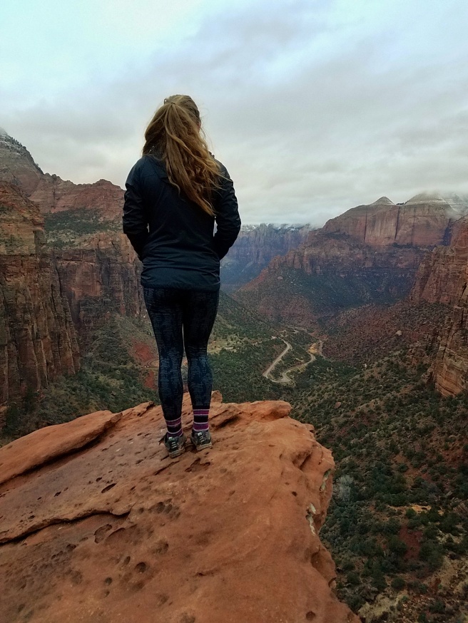
This is a nice short trail that is unique and ends with stunning views of the canyon.  There are cliff and drop off areas, so for very young children you will want to carry them.  My 6 year old did great on his own.

Trails of Davis County Part 1

Davis County Utah has so many trails that we haven’t even visited them all yet!  One of the most well known trails is Adams Canyon Waterfall, but there are so many more.  Hopefully you’ll find some on this list you haven’t tried just yet.  Here are 12 of our favorites in the Davis County, UT area.  Stay tuned for Part 2 for even more trails, I didn’t want to put them all on one post, there are just too many!!

Farmington Canyon Trail/ Farmington Creek Trail/ Sunset Trail/ Farmington Waterfall Hike

Little Mountaineers Rating: Moderate (3.2 mile round trip, the trails climbs up and descends down multiple times, some drop offs and steep areas)

This trail seems to go by a few different names.  It is famous for it’s 2 waterfalls and several old deteriorating cars along the trail.  With great veiws of the canyon and valley, creek crossings, colorful leaves in the fall, waterfalls, old cars, and interesting rock formations, you will find surprises around each corner.

This is going to be a moderate/hard hike for toddlers on their own feet.  Young children 6+ should do good on their own, especially if they like to hike.  I usually carry my 3 year old part of the way and let her walk when she wants to.

At just over 3 miles round trip you will get in a good workout without it being too difficult.  Plan on elevation changes throughout, it will climb and descend several times.  Packing my toddler I do this hike in about 2 hours, with a couple short breaks.  Plan more time and you get to go slower and explore more.

At the end of the hike you will be able to see the “big waterfall” below you.  There is a very steep area to descend to get up close to the waterfall with a rope to help you down.  I would not recommend this with young children.  After we gaze down at the awesome waterfall we turn around and head back the way we came.  I believe you can continue on and go up a steep trail that will connect you with Sunset Campground but I’ve never done it.


Deuel Creek South Trailhead

Little Mountaineers Rating: Moderate (2 mile round trip to rope swing, some steep areas and drop offs, some rock scaling, creek crossings )

When you look up information on Deuel Creek you will notice it has two trail heads and can be hiked as a loop trail.  The North Trail head is steep with loose dirt and rocks and with little shade so not young child/toddler friendly.  Luckily the South Trail head is not the same and it can be hiked out and back for a short, scenic, shady hike to a rope swing.  The South Trail head follows along side the creek with several fun creek crossings on log bridges.  It is very shady and a perfect place to cool down from a warm sunny day.  From the start of the South Trail head to the rope swing is just over 1 mile.  Hike back the way you came for a round trip hike of around 2 miles.  It took us a couple times to find the rope swing.  When you get to the creek crossing that only has 2 longs do not cross the creek.  Stay on the south side of the creek and continue straight for a short while and you will reach the swing.  There are some steep areas, areas with drop offs (don’t let your littles wander off ahead of you!) and some areas where you will scale some rocks.  Take it slow and watch you step and you’ll really enjoy this trail.  This is probably one of our top favorites.


Parrish Creek Trail to Pictographs

Little Mountaineers Rating: Easy Moderate (1.1 mile round trip to pictographs, some rocky areas and rock scaling to final pictograph area may require extra help)

This short trail to the pictographs is mostly easy, however requires a bit of scrambling/climbing on a rocky area to reach the pictographs at the end.  If you are bringing children with you I recommend you have at least 2 adults for improved ease navigating the final rocky area.  From what I have researched these are from the Fremont Indians.  Please respect this rock art so others can enjoy.  We turn around at the pictographs area and head back the way we came.


Antelope Island Buffalo Point Trail

Little Mountaineers Rating: Easy Moderate (.8 mile round trip with uphill climb to top, rocks to climb and explore on top)

Antelope Island is one of my favorite places to hike in the area.  The landscape is very unique and different than your typical mountain hike.  Buffalo Point is a short hike that takes you up to a point with a lovely view and a great place to watch the sunset.  There are many rocks to further climb and explore at the top.  This is uphill to the point but nothing too steep or challenging, my 3 year old now hikes it on her own.

*Antelope Island has a “biting gnat” season that usually goes from April-June (call ahead for status), these are pesky little buggers so go early Spring or Fall for the most enjoyable time!


Antelope Island Ladyfinger Point Trail

Little Mountaineers Rating: Easy (.5 mile round trip, rocky areas and drop offs)

This trail is a great place to watch the sunset and let your kids climb rocks and explore.  This is my favorite place to take the kiddos when they just want to play and not do much hiking.  This trail is super short and you already have a great view along with many rocks to explore.

*Antelope Island has a “biting gnat” season that usually goes from April-June (call ahead for status), these are pesky little buggers so go early Spring or Fall for the most enjoyable time!


Antelope Island Lakeside Trail

Little Mountaineers Rating: Moderate (5.6 miles round trip, mostly mild elevation gain, some rocky areas, rated moderate for distance)

This trail is the longest trail on the list, but don’t let that scare you.  This trail is mostly mild and has stunning views of the Great Salt Lake.  There are many areas with fun rocks to explore and this one will be great for the kiddos.  This hike doesn’t have anything waiting for you at the end, the whole trail is scenic, so if you only do part of the trail you will still be able to experience the unique beauty of this trail. You can start this trail from either end, there is parking and trail head signs at both ends.

*Antelope Island has a “biting gnat” season that usually goes from April-June (call ahead for status), these are pesky little buggers so go early Spring or Fall for the most enjoyable time!


Fernwood Trail Segment of Bonneville Shoreline Trail

Little Mountaineers Rating: Easy Moderate (1.8 miles one way to Adams Canyon Trailhead, some elevation climb)

This trail is literally just a few minutes from our house so it’s a quick easy trip for those days we need some mountain therapy but don’t have much time.   We usually just walk along the trail for as long as we feel like it, usually 1-2 miles round trip,  not usually the whole segment.  There are a couple stream crossings depending on how far you go.   This is another trail with little shade but great sunset views.


Davis Creek

Little Mountaineers Rating: Moderate Hard (around 3 miles round trip depending on your route, steep areas, drop offs, rocky and steep decent, trail not always clear so map and good knowledge of trail recommended)

This is a unique trail in the Davis County area and has some very steep, exposed areas.  There are also other trails in the area that connect and cross with this trail so you want to research your route thoroughly before you go.  You’ll find multiple waterfalls, “Indian bathtubs”, pine forests (“Christmas Tree Lane” and the “El Capitan” rock, etc.

When I researched this trail I noticed that many people stop at the area with the Indian Bathtubs and 1st waterfall.  The trail up to this point is pretty easy to follow and the Indian Bathtubs and waterfall are a great place to turn around if you are looking for something shorter and not as strenuous.  I would recommend stopping here if you have not researched and mapped out the rest of the trail, since there are other trails that cross here you could get turned around if you are not familiar with the surroundings.  If you are up for a challenge and do your research, I like to hike from the Indian bathtubs and do a loop to Pretty Valley then to Hell Hole up to another waterfall and through “Christmas Tree Lane” and a steep decent back to where you started.  Whew definitely a workout with a 35lb toddler on your back and not much shade.


Patsy’s Mine

Little Mountaineers Rating: Moderate Hard (2.1 miles round trip to caves including some cave exploration, steep climb with rocky areas and drop offs, no shade)

So when we hiked this trail we parked down in a cul-de-sac and hiked up to the dirt road where you will find a trail head.  There is a dirt road that takes you up to that point, but it was in very poor condition when we went and we didn’t want to risk driving on it.

This trail is basically a nice steep climb up, so be prepared for a burner.  There is no shade and the path is steep with drop offs.  It can also be difficult with loose rocks and dirt.  My 6 year old did fine on his own, but I carried my 3 year old the whole way until we reached the caves.

We explored the caves until we got to a part where it branched off into different trails and started to get really wet.  The kids thought it was super cool to explore.  It felt nice to cool off from the hike.  Bring flashlights!  We headed back and finished the hike while enjoying the beautiful sunset.


Farmington Lakes Trail

Little Mountaineers Rating: Easy (less than 1 mile/unsure, trail can be wet and muddy)

So we’ve been exploring this little trail with our kiddos for years but I really have no information about it.  I can’t seem to find a trail name or description anywhere.  It does seem that the ponds are called “Farmington Lakes” so I’ve decided to name the trail that.  When you are driving up Farmington Canyon and over to Bountiful peak you’ll pass a camping/picnic area on the Bountiful side and then you should see these ponds on the side of the road shortly after that.  If you pull over and park you will find there is a little trail here.  We’ve never gone too far, it usually gets too wet and muddy, but it is a fun little area to explore and we even bring our hammocks here sometimes to relax.  One of our favorite ways to escape the summer heat is to head up to higher elevation and this is one of our favorite little spots.  Let me know if you have any more information about this trail, I’d love to learn more about it.

Here is a link to the google map coordinates for Farmington Lakes.


Adams Canyon

Little Mountaineers Rating: Moderate Hard (3.6 miles round trip, starts out with switchbacks, steep strenuous climb up canyon, some rocky areas and drop offs)

This is a very popular trail in Davis County, but probably isn’t my first pick for beginner hikers or hiking with toddlers.  I hike this with my daughter on my back when I want a good work out!  The first part of the hike is up about 11 switchbacks (worst part in my opinion ha ha)  As you hike this trail into the canyon you will quickly see why it is so popular, it truly is very beautiful.  Hiking along the creek, through the pines, and passing waterfalls and interesting rock formations you will end and the stunning waterfall.  Avoid weekends and holidays if you don’t like crowds, but since it is popular you will most likely see a good amount of people on the trail.


Wildrose Trail

Little Mountaineers Rating: Easy Moderate (2 mile round trip to sunset view point, some some steep areas and drop offs, moderate climb to top)

This is a good after school or after work sunset hike.  It’s a mile up to the sunset view point and although you are climbing up, it isn’t too steep or difficult.  It is mostly exposed with a little shaded area.  There are beautiful views of the valley and city below and the lake off in the distance.  This trail also connects with other trails (so watch for signs) and can be hiked as a out an back (starting and going back the same route) or as a loop and hiking back down a different way.

I hope you’ve enjoyed learning about some of the trails around our home!  I can’t wait to post even more.  Hopefully you’ll be able to try out a new trail or two in the Davis County area!  Happy Hiking!

Arches National Park

We had a chance to visit Arches National Park this February and all I can tell you is that my kids were absolutely in love.  I’ve always loved this park and it was fun to see it differently through the eyes of my children.  I have a good friend who lives in New Mexico and the other day we found out that Moab, UT was the half way point between us.  What better reason to plan a fun weekend getaway.  Just moms and kiddos this time (2 days,2 moms, 5 kids 7 and under).  Needless to say things were crazy, but we had a blast.  I hope these kids cherish these memories, I know I will.

Here is a link to the current Arches National Park guide.  This park is so family/kid friendly.  You’ll notice that there are 7 trails 1 mile round trip or less and 3 trails 1-2 miles roundtrip!  Don’t worry, there are also some great longer/harder trails too.  The drive through the park is a gorgeous scenic drive and you’ll feel like you hundreds of miles from civilization (you kind of are).  You’ll also probably feel like you took a trip in the time machine back to when dinosaurs roamed the red rock.

wp-1487903383426.jpgThe animal statues at the visitors center were a real hit with the kids.  They were hugging and kissing them goodbye.  Awe, to be a kid again.

20170216_164929-01.jpeg

Our first stop along the scenic drive through Arches NP was Park Avenue!

wp-1487903127648.jpg

Little Mountaineers Rating:  Easy Moderate (2 mile round trip, 320 ft elevation change, section of rock stairs, some rocky/sandy areas)

Picture above is majestic Park Avenue trail.  This 2 mile round trip trail is so surreal.  Don’t let the stairs scare you, they aren’t too bad!  My kids actually loved the stairs, so much that my daughter kept asking to go back to them.  You can start this trail from either end and even have someone pick you up at the end so you only do 1 mile.  Even if you don’t do the whole trail it is definitely worth the stop and the view.

wp-1487903116577.jpg

Next up was The Windows trail.  This easy trail takes you on a path to explore two large windows and Turret Arch.  While we were there we were able to see researchers in action on top of the first Window, they used parachutes to send their equipment down and rappelled off the side.  Pretty neat!

Little Mountaineers Rating: Easy (1 mile round trip, mild climb with some areas with stairs)

wp-1487903266558.jpg

The Windows come with some pretty amazing views!

wp-1487903365053.jpg

We were lucky to be here during great weather!  Blue skies and low 60’s.  February can be hit or miss with weather.  As we were leaving it was raining which even turned to snow on the way back to Salt Lake City.

wp-1487903376343.jpg

Sibling love!  I’m glad these too get to share these memories together!

wp-1487903143867.jpg

Above you can see both the North and South Windows.

wp-1487903615271.jpg

Turret Arch is also a part of this short hike.

wp-1487903156072.jpg

The red rock desert is so stunning against those blue skies!

wp-1487903342701.jpg

After we said our goodbyes to our New Mexico friends we were getting ready to head home.  Well my children decided there was no way they wanted to head home yet.  We still had a few hours so we headed back to Arches to do a couple more trails on our own.

wp-1487903660152.jpg

Our first stop was Delicate Arch.

Little Mountaineers Rating: Moderate (3 mile round trip to Arch, 480 ft elevation change, multiple areas of uphill climb, steep slick rock climb area, some rocky/sandy areas, some ledges/drop offs.  No shade, this hike becomes more difficult in harsher weather conditions)

My son has a rock book he got for Christmas and there is a picture of Delicate Arch in the book.  He was eager to see it in person so we decided to head out.  I knew my 3 year old daughter was not going to be able to do this trail on her own, so she got to ride in our Onya Baby Pure carrier.  The guide says to give yourself 2-3 hours for the trail.  We completed this trail in under 2, partly because it wasn’t sunny or hot and apparently my son was an energizer bunny that day!  Weather can make this trail deadly.  In the summer I would advise going early in the morning or later in the evening and bringing plenty of water and snacks.  I’ve hiked this hike in August when it is extremely hot, but we did it as a sunrise hike, even then it was warm.  I loved this hike in February, it is nice not to have the heat!  This hike isn’t too long and has a few areas of uphill climb to give you that great leg workout and get your heart pumping, but I don’t consider it an extremely difficult hike which is why I gave it a moderate rating.  I would definitely plan on carrying your baby/toddler/preschooler age child and make sure you rest when needed especially during the steep climbs.

wp-1487903230943.jpg

Different rock formations to see along this trail!

wp-1487903635188.jpg

Once you see this little window you know you are almost there!

wp-1487903099064.jpg

Delicate Arch!  Even more stunning in person.  My son’s reaction when he rounded that last corner was priceless.  He was truly in awe and couldn’t believe how big it was in real life.  He was such an amazing hiker this trip!   It’s so fun to watch them grow and learn.

wp-1487903088058.jpg

It always seems a little windy near the arches.  Guess that makes sense.  Here is our lovely windy Delicate Arch selfie.

wp-1487903245196.jpg

wp-1487903216690.jpg

If you don’t think you are ready to tackle this hike you can still take your kids to see the cool rock art panel, it is at the start of the trail and doesn’t require any uphill climb.

We decided to tackle another quick trail before we headed home so we headed over to Skyline Arch.

Little Mountaineers Rating:  Easy (.4 mile round trip flat and sandy areas)

wp-1487903198178.jpg

Of course whenever my kids see rocks/boulders they have to climb them.

wp-1487903183912.jpg

Just like pretty much everywhere we go, we left wanting more.  Moab has so much to offer, even more than just Arches National Park.  We only touched on a few of the trails this post but I can’t wait to share more later on.  We only spent 2 days here this time, but it was definitely worth it, there is so much to see even in a short period of time.  Happy hiking!

Check out our little bonus adventure below!

20170216_142922-01.jpeg

You thought dinosaurs were extinct…well not in Moab!  We decided to take all the kiddos to Moab Giants Dinosaur Park after our long drives to let them play and get some energy out before we checked into our motel.  We didn’t pay for the museum or any of the indoor stuff, we just did the Dinosaur Trail to see all dinosaur statues and there is also a playground area for kids to play on.  To do this portion of the park it is 12$ for kids 4 and older and 16$ for adults.  The dinosaur statues were really cool, and looked liked they fit right in with stunning Moab as the backdrop.

20170216_143022-01.jpeg

Winter at Zion with ZionAdventurePhotog

Upper Emerald Pools Trail

Little Mountaineers Rating: Moderate (2.2 mile round trip to upper falls, 436 ft elevation change, uphill climb, some rocky/sandy areas)

We have visited Zion National Park during every season except for winter.  So last month when we were traveling to Southern Utah over Christmas break we decided to check it out!  We had the lovely opportunity to meet Arika with ZionAdventurePhotog and had her follow us around on our hike to Emerald Pools and capture our experience!  You guys, this was seriously the best idea ever!  We loved our experience.  Check out her website HERE and check her out on Facebook and Instagram @ZionAdventurePhotog.

When we first heard about Arika and what she does, we were very intrigued.  I mean who wouldn’t want unique high quality photos adventuring with those you love?  You’ll see how she took a mix of candid and slightly posed shots of us as we conquered the trail with our family.  I never had to worry about taking pictures or hoping to get a decent selfie.  We got to enjoy the scenery and each other as she worked her magic making our memories last forever.

If you have never been to Zion or have and want your memories captured in a unique way, I definitely recommend going through ZionAdventurePhotog!  It would also be an awesome unique gift for someone who loves to adventure with their family.

We are happy to report that we definitely recommend Zion in the winter!  With recent rain the waterfalls were in full force, and the misty cliffs and cloudy overcast skies were a dream.  Temps were in the 40’s and comfortable with light layers.  During the winter, Zion Canyon is open to cars (yay no waiting for shuttles!) which makes it really convenient for families.  You can drive to the stops you want, and can leave whenever you want, and you don’t have to worry about shuttle crowds or schedules.  It is also less crowded this time of year!  We only had a day here this short trip, but we were glad we scheduled some Zion time.  Find more info below!

Zion National Park Website

Zion Winter Map & Guide

EMERALD POOLS TRAIL (PHOTOS BY ZIONADVENTUREPHOTOG)

15875447_10154706217065661_2204501343182736956_o

i-2j5rkkc-m

i-6vjg5z2-m

i-bvm8rjq-m

i-7mfpx7m-m

i-h6xxhdh-l

i-hp9zg3q-l

i-rg2jlkt-l

i-stzhnwk-m

i-f8pdxr4-m

i-rljskzb-xl

i-khs6rnk-l

i-fhrhjjj-m

i-b9fwnrc-m